Members of the public are being invited to share their thoughts on some possible transportation improvements that have been suggested for highways in the Kamloops area.
This second phase of consultation for the Kamloops Area Transportation Strategy will help build a better understanding of current and future transportation needs in and around the city, which is described by the province as “a vital connection point between the Trans-Canada Highway and Yellowhead Highway 5. In addition to its importance for travel within Kamloops and B.C., the area is a crucial part of the highway system that is of national importance for goods movement and long-range travel.”
Phase one of the strategy (which can be viewed at https://bit.ly/3keciIq) involved collecting feedback about what is important to travellers to, through, and within Kamloops. Nearly 600 B.C. residents and 20 advisory groups suggested a variety of improvements, and the phase one report noted that there was widespread agreement on the major issues. The province is now looking for feedback on these suggestions.
Highway 1 from the Afton interchange west of the city through to Valleyview elicited comments about the difficulty drivers have merging onto the highway from Columbia Street. A reconfiguration of the Columbia Street on-ramp to Highway 1 has been included in the plan. There were also comments about the challenges presented by slow-moving commercial vehicles on the steep grades between the Yellowhead interchange (junction of Highways 1 and 5) east of the city and Summit Drive, with trucks trying to pass each other going up the hills the biggest concern.
Traffic congestion and merging challenges at the Yellowhead interchange were cited as one of the biggest concerns for drivers in the region, and Highway 1 through Valleyview was another major concern. The Vicars Road intersection in Valleyview was the biggest concern singled out in the entire region, although survey respondents recognized the constraints presented by the frontage road, the nearby railway tracks, and local businesses. Traffic congestion from closely spaced traffic lights and frontage roads along the corridor drew comments, while nearby railway crossings were described as creating mobility and safety concerns.
More and better cycling routes and safe pedestrian routes in various areas of the city, as well as better signage, were among the other improvements cited in phase one.
This second phase will allow people to review all the suggestions, in order to help evaluate potential transportation improvements over the short-, medium-, and long-term. Phase two input will be used to evaluate and prioritize the suggestions.
Based on the feedback received, a third phase of engagement will share the recommended strategy and next steps. It is hoped that the strategy will be finalized by the end of this year.
People are invited to share their views online at https://gov.bc.ca/kamloopstransportationstrategy. The website includes information about the strategy and an online survey, which will be available until March 5. You do not have to be a resident of Kamloops in order to take part.
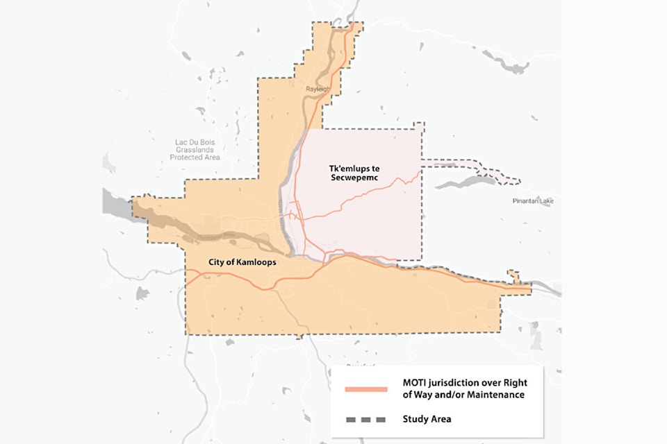
The strategy area consists of the provincial transportation network within the boundaries of Kamloops and Tk’emlúps te Secwépemc, including:
* Highway 1 from Afton Interchange underpass in the west, to the Lafarge Road Interchange in the east;
* Yellowhead Interchange of Hwys. 1 and 5;
* Highway 5 from the Yellowhead Interchange to the Old Highway 5 intersection; and
* additional provincial roads and infrastructure.
editorial@accjournal.ca
Like us on Facebook and follow us on Twitter